|
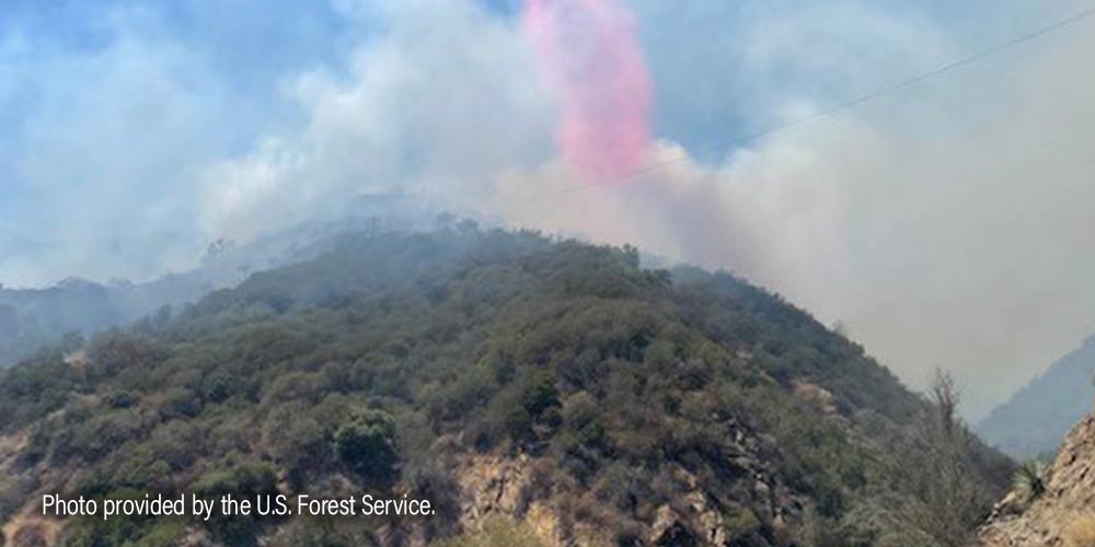
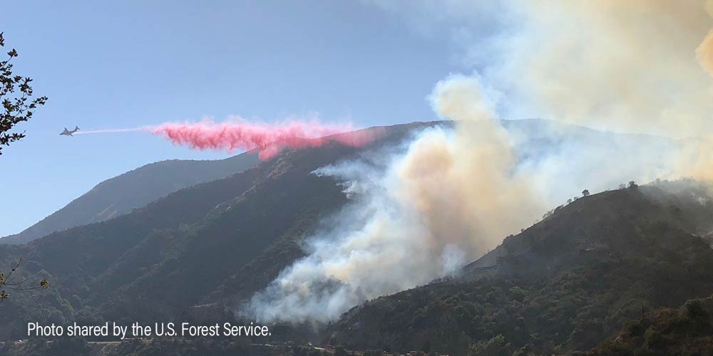
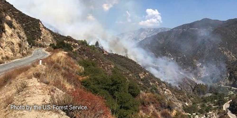
Written by AARON CASTREJON CityWatch Editor MOUNTAINS – San Gabriel Canyon will be temporarily closed Labor Day weekend due to ongoing fire operations, according to the U.S. Forest Service.
Vehicle, pedestrian, equestrian and all other recreational activity is off limits. The Gulch Fire has burned 113 acres and is 78 percent contained as of Thursday night. There are 98 firefighters remaining on scene, according to the U.S. Forest Service. Highway 39 remains closed from the San Gabriel River Bridge to Crystal Lake Road. East Fork Road remains closed from Highway 39 to Glendora Mountain Road, the latter is closed from the border of Glendora to East Fork Road. Glendora Ridge Road is closed from Mt. Baldy Road to Glendora Mountain Road. The cause of the fire is under investigation. Written by AARON CASTREJON CityWatch Editor MOUNTAINS – Crews worked through the night to gain ground on a stubborn brush fire, the third to scorch the hillsides this week.
The most recent Gulch Fire, which ignited just before Noon August 29, has burned 100 acres near Highway 39 near the San Gabriel Dam. Firefighters have not reached containment on the fire as of Monday night. Highway 39 from the San Gabriel River Bridge to Crystal Lake Road remains closed, according to Caltrans. The East Fire, which ignited near East Fork Road and Glendora Mountain Road August 25, has burned 150 acres and is 93 percent contained. The East Fire remains in its footprint as the remaining 148 firefighters on scene continue suppression and mop-up operations, according to the U.S. Forest Service. A small 40-foot by 40-foot spot fire was quickly snuffed out August 29 by Los Angeles County Firefighters in the hillsides of Glendora right behind Church of the Open Door, 701 W. Sierra Madre Ave. Written by AARON CASTREJON CityWatch Editor MOUNTAINS – The fire burning in the steep terrain of the San Gabriel Mountains National Monument is nearly out, authorities said Sunday.
The East Fire, burning north of the La Verne/Glendora area, is 93 percent contained and has already burned 150 acres, according to the U.S. Forest Service. No evacuations were needed and no structures were threatened by the fire that ignited near Glendora Mountain Road and East Fork Road August 25. East Fork Road remains closed from Highway 39 to Glendora Mountain Road. Glendora Mountain Road remains closed from the City of Glendora to East Fork Road. Glendora Ridge remains closed from Mt. Baldy Road to Glendora Mountain Road. The fire’s cause is under investigation. Written by AARON CASTREJON CityWatch Editor UPDATE, 9:12 a.m.: Authorities are investigating a possible human aspect to this fire on East Fork Road. A suspect has been detained on an unspecified trail in the area near the fire. the CHP and county deputies are en route to the detained suspect.
UPDATE, 9:07 a.m.: Forward progress on the fire has been stopped at four acres. Aircraft have helped tremendously in keeping the flames from spreading, according to the U.S. Forest Service. MOUNTAINS - The Los Angeles County Fire Department and U.S. Forest Service firefighters are responding to a brush fire along East Fork Road near Glendora Mountain Road above San Dimas. A technician with the US Forest Service reports three to five acres running slowly uphill. The fire was reported around 7:51 a.m. Written by AARON CASTREJON CityWatch Editor UPDATE, 2:51 p.m.: Firefighters revised acreage several times and the Soldier Fire is now just under an acre burned, according to the U.S. Forest Service. There were no victims inside the crashed vehicle. The two occupants who climbed to the road were airlifted by a Los Angeles County Sheriff's helicopter. MOUNTAINS - A five acre brush fire has ignited along Highway 39 at mile marker 35.29, the U.S. Forest Service is reporting. The U.S. Forest Service is in scene and is requesting assistance from the Los Angeles County Fire Department and the California Highway Patrol. Firefighters believe a vehicle crashed over the side of the road and ignited the fire. Possibly two occupants from the crash found their way to the road. It is unclear if anyone else may still be in the vehicle, according to the U.S. Forest Service. An existing hand line put in place by firefighters who worked the Bobcat Fire is helping to keep flames back. Written by AARON CASTREJON CityWatch Editor REGION - Authorities have lifted many of the evacuation orders in the Los Angeles and Antelope valleys over the past several days as cooler temperatures have helped firefighters make serious gains on the gargantuan Bobcat Fire. The Bobcat Fire was downgraded to 62 percent contained and has burned 114,200 acres since igniting September 6. Santa Ana winds are forecasted for Monday, bringing warmer and drier conditions to the area and increasing the risk for increased fire activity, according to the Bobcat Fire Unified Incident Command Team. A Red Flag Warning is scheduled from 5 a.m. to 5 p.m. September 28. Authorities began initiating repopulation of some affected areas September 24 in Little Rock, Pearblossom, Juniper Hills, Valyermo, Llano, Big Rock Springs and Largo Vista.
Remaining under evacuation orders are Paradise Springs south of Big Pines Highway, east of Devil’s Punchbowl, west of Largo Vista Road, and north of the forest; south and west of Upper Big Tujunga Canyon, east of Angeles Forest Highway and north of Angeles Crest Highway; Residences along Angeles Crest Highway, between Angeles Forest Highway and Highway 39. Remaining under evacuation warnings are areas south of Big Pines Highway, east of Largo Vista Road, west of 263rd Street E (County line), and north of the forest; south of Mount Emma Road, north of Upper Big Tujunga Canyon, east of Angeles Forest Highway, and west of Pacifico Mountain; East Fork Areas of Julius Klein Conservation Camp 19, Camp Williams, the River Community and unincorporated Wrightwood. For a current list of affected areas, visit the Los Angeles County website for up to date changes. Evacuation Warnings Lifted for Some SGV Communities as Bobcat Fire Tears Through Antelope Valley9/21/2020 Evacuation Warnings Lifted for Some SGV Communities as Bobcat Fire Tears Through Antelope Valley9/21/2020 Written by AARON CASTREJON CityWatch Editor REGION - The looming threat of destruction from the Bobcat Fire is largely gone for Duarte, Bradbury, Monrovia, Arcadia and Sierra Madre after authorities lifted evacuation warnings over the weekend. The evacuation warnings were lifted at 4 p.m. September 19. The Bobcat Fire has scorched 105,345 acres and is 15 percent contained, according to the Bobcat Fire Unified Incident Command Team. Evacuation warnings remain in effect for Pasadena and Altadena. More than 50 square miles have burned across the San Gabriel Mountains and has made headway into the Antelope Valley where homes and other structures have been turned to ash and rubble. The fire continues to threaten and has destroyed homes in the communities of Juniper Hills, Paradise Springs, Devil’s Punchbowl where evacuation orders remain, according to the Bobcat Fire Unified Incident Command Team. Unfortunately, homes did burn in the Antelope Valley area.
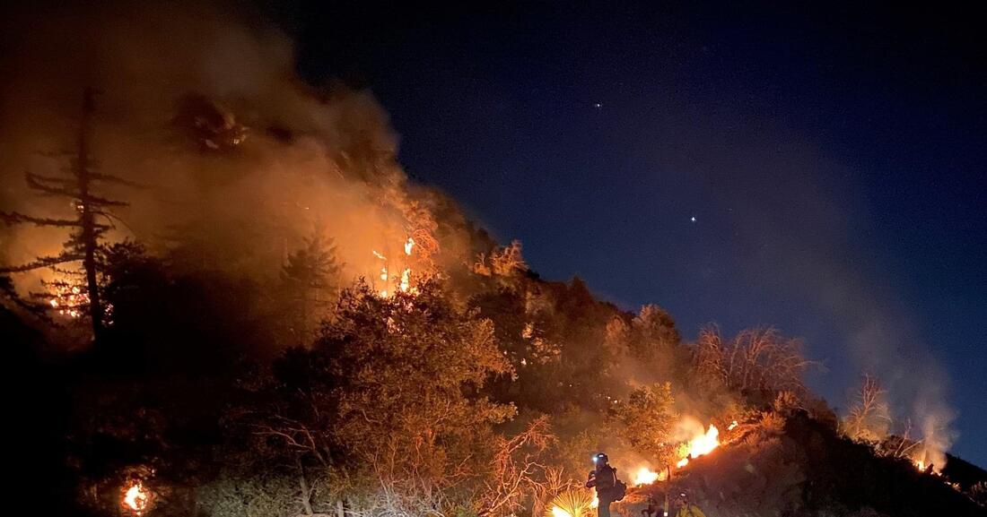
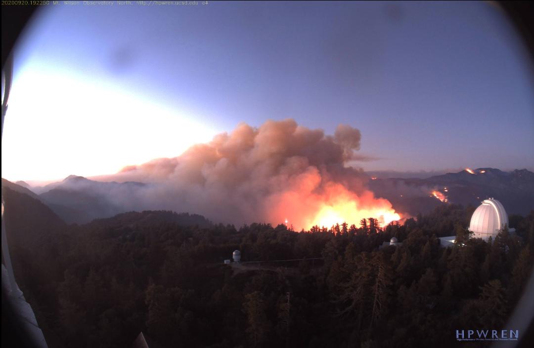
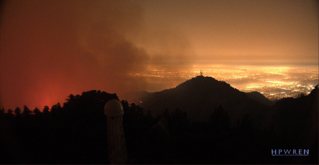
Communities near the burn area under evacuation warnings include Pasadena, Altadena and Wrightwood. For a complete list, click this link. Firefighters continued to hold special emphasis on strengthening fire lines around the Mount Wilson observatory, which is still standing even as the bobcat fire continues to move westward. Southerly winds, sometimes gusting to 20 miles per hour up canyon and 30 miles per hour at the ridges, helped to drive intense fire activity in the San Gabriel Mountains wilderness area. Wind intensity is expected to remain unchanged today. An evacuation center for residents is located at Palmdale high school, 2317 East Ave. R. The Antelope Valley fairgrounds, 2551 W. Avenue H in Lancaster, are open to accommodate large animals. Written by AARON CASTREJON CityWatch Editor REGION - The Bobcat Fire continues to churn its way through the San Gabriel Mountains and has burned 44,393 acres, authorities said Tuesday night. As the fire continues to burn westward towards Mount Wilson and northbound across Angeles Crest Highway, activity on the eastern flank has lessened to the point where mountain residents and workers east of San Gabriel Canyon Road have been allowed back. Fire activity near San Gabriel Canyon Road has diminished to the point where authorities gave residents of the Camp Williams area the opportunity to return home. The burn scar created by the Ranch 2 Fire is helping to keep flames west of the road. The occupants of River Community Rehab and Camp 19 along East Fork Road have also returned, according to the U.S. Forest Service. The fire remains 3 percent contained. The infrastructure at the Mount Wilson observatory property remains standing after very diligent work by firefighters who strategically burned away problematic vegetation in the nearby area. Established fire lines created by bulldozers were complemented by fire fighting operations from the air, the U.S. Forest Service said.
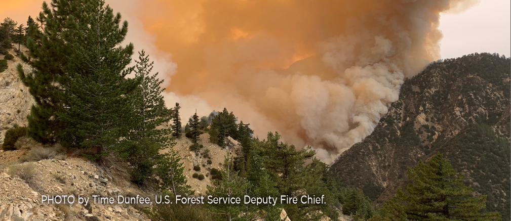
The already established defensible space around the Mount Wilson Observatory also greatly helped in keeping flames away from the historical site. Simultaneously, firefighters continued their diligent work on maintaining fire lines on the southern flank of the fire where homes nestled in the foothills of Arcadia and Monrovia stand. Residents of Monrovia likely saw fire activity near the Sawpit Dam and Spanish Canyon areas Tuesday night as firefighters strategically burn vegetation to strengthen defensible space. Despite firefighters’ efforts, a spot fire jumped north of Angeles Crest Highway and burned 500 to 1000 acres Tuesday. The spot fire was eventually extinguished, according to the U.S. Forest Service. Evacuation orders were issued for residents in the area north of Angeles Crest North and between Clear Creek Station and San Gabriel Canyon Road., the U.S. Forest Service said. Residents and business owners that live in the East Fork area between Highway 39 to the west and Glendora Mountain Road to the east can access their community through Glendora Mountain Road in Glendora, the U.S. Forest Service said. Residents of Arcadia and Sierra Madre neighborhoods north of Elkins Avenue and east of Santa Anita Avenue are still under mandatory evacuations. A Red Cross evacuation center is available at Santa Anita Park, 285 W. Huntington Dr., in Arcadia. Enter through Gate 5. Call 1-800-675-5799 for more information. Written by AARON CASTREJON CityWatch Editor REGION – The stubborn Bobcat Fire tearing its way through the San Gabriel Mountains is 6 percent contained Friday, the U.S. Forest Service said. 26,368 acres have burned in the steep, rugged mountain terrain since the fire’s inception five days ago. 540 firefighters from surrounding agencies, assisted by helicopters and some fixed-wing aircraft, continue to focus work on the south and north flanks of the fire that continue to grow. Firefighters achieved containment on the eastern flank where the Bobcat Fire ran into the burn scar etched by the Ranch 2 Fire, the U.S. Forest Service said. Two air tankers were able to perform drops of fire retardant Thursday after dense smoke on the south flank above Monrovia lifted. A helicopter and two groups of camp crews were also sent to bolster fire lines there, the U.S. Forest Service said. Overnight, two Los Angeles County Fire Department helicopters equipped with night vision were able to tend to flames on the south flank.
Winds continue to push the fire north towards Crystal Lake. Flames have reached the into the upper ridges near Angeles Crest Highway where fire retardant line have been laid by aircraft, the U.S. Forest Service said. Ground crews will continue to patrol the foothill communities and conduct structure protection and triage efforts, the U.S. Forest Service said. The City of Monrovia has established road blocks along planned evacuation routes and bolstered the areas with additional police patrols to push non-residents and unnecessary traffic out of the area, Monrovia city officials said. Unnecessary vehicle traffic created what Monrovia officials considered public safety concerns and apparently even delayed fire trucks from being able to move from location to location, Monrovia city officials said. Firefighters estimate the Bobcat Fire may be contained by October 15. |
Archives
January 2024
Categories
All
|

 RSS Feed